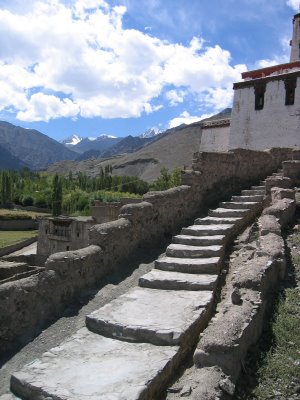
in through the out door

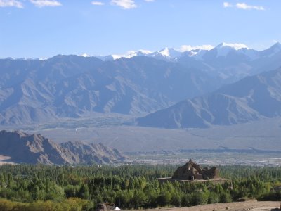
looking west down the shyok valley...the town of diskit is lurking in the trees below while the town of hundar lies in the dark cluster in the distance. at the western edge of hundar lies the end of the road for foreigners, beyond which hides the karakoram mountains and the pakistan border.
today, the warmth of the sun is diminished and the blowing clouds bring a new dimension to the landscape. late october heralds the end of the tourist season here, and the inevitable exodus begins. fresh snow has been piling up on the mountains for a few days and the non-natives are restless.
under gloomy skies, i overhear a group from france pondering the choices...is it travel to manali? well, this would be via a cramped taxi with questionable tires...negotiating a brutal road over a high pass, likely covered in snow and ice! or is it the expensive flight to delhi? perhaps, but it could be delayed for days if the weather keeps up. the israelis have left weeks ago for manali, mcleod ganj and on to the beaches of goa. the north americans (and a smattering of scandinavians and other various northern europeans) appear to have more endurance and are staying on, but the reality is that many of them are here for purposes beyond simple pleasure or recreation. some may be working on their master's degrees or doctorates, others are engaged in humanitarian projects or working with NGOs.
they stay because they need to. i stay because the energy here is healing...to hell with the weather. yes, my toes are cold as i stubbornly slip my naked feet into my flip flops en route to the main bazar, but the lure of warm weather to the south is temporary. i know the heat will still be present in the southern states for many weeks and months to come. there is still much to explore here in ladakh.
a few days ago, an australian couple (two of the last of the aussies and kiwis to linger in ladakh) accompanied me on a trip over one of the highest motorable passes in the world, with an eye to visiting the nubra and shyok valleys to the north. these valleys are within the "inner line" area...permits required for the foreign traveler. the single-lane, rocky road snakes its way up the high mountain slopes. switchback follows switchback.
along the way, we pass a group of road workers as they repair the potholes with hand tools. unlike back home, there is no support vehicle, no machinery, just a group of men and women with shovels and picks and brooms...oh yes, and the necessary implements to make tea.
we have hired a taxi to shuttle us to our destination. our taxi is a newer and nicer number than the typical toyota "qualis" or the suzuki "omni" mini-vans that run about the land. the morning rush to get over the pass is undertaken by military convoys, commercial trucks, local buses and the tourist taxis. the smaller and more nimble vehicles soon catch up to the ornate yet sluggish trucks...lumbering along on the slow, uphill journey to the pass. overtaking another vehicle on this twisting, narrow and crumbling road is both breathtaking and hair-raising.
the game goes something like this: after a long session of horn blowing by the "passer", the "passee" pulls to one side - a reluctant and slight shift of a meter at best. if the "passee" is a truck, you can guarantee that they will not slow down at all while they provide room for you to pass. the "passer" now has the daunting invitation to squeeze by with little to spare on either side and must accomplish the task in a very short distance. typical passing opportunities - comprising of a marginal and brief widening of the road - measure around six car-lengths...not a lot of space to accelerate and get passed a moving vehicle.
several times, our driver skillfully - or luckily - squeaked past hulking, belching road warriors that make up the commercial vehicles of india...sometimes with only centimeters to spare. as we near the pass, we come to the south pullu, the military and police checkpoint where permits and passports are perused. the "inner line" or protected areas are near sensitive and disputed borders with pakistan and china, therefore no lone foreigners (who might be spies) are allowed to venture into these hinterlands. instead, foreigners are only allowed to travel in groups of four or more. the government's expectation is that groups will register for permits through a local travel agent who in turn will obtain the permits from the government tourism office. apparently, this will allow the government to keep tabs on us in the protected areas.
this is india, however, so the bureacratic machine - although enveloped in red tape - is riddled with loop holes. a single foreigner can apply for a permit with almost any trekking agency. the three missing people and their passports are miraculously produced and the permit is secured. how? just ask around at your guest house if anyone minds having their names on the permit - no need to actually go on the trip, just a photocopy of your passport, please! no takers? no problem. simply use the passport photocopies from the last group that came through and add their names to the list. they'll never know!
but wait, you say...what about the checkpoints? how does one person pass through if the requirement is four? no sweat. only the permit needs to be complete with four or more people; the actual number of travelers is moot.
as an example, our scenario unfolded as follows: the aussie couple obtained a permit through a trekking agent in the main bazar. although only two people, they managed a permit for four. i arranged for a permit through my guest house, and was given a permit listing six people. in one taxi, we arrive at the checkpoint with two permits for ten people yet only three on board! we wait in the car while the taxi driver takes the permits to some officer inside the checkpoint's office. the soldiers at street level don't ask any questions, and the officer who views the permit never actually sees us.
allowed through the south pullu, it's onwards over the desolate pass, down the north side and to the north pullu (at an altitude of 16,000 feet). here, hundreds of soldiers wander - apparently aimlessly - around the ramshackle collection of temporary and beaten buildings, surrounded by massive military trucks and tiny tea stalls. all the soldiers are wrapped in white, army-issue down jackets and white scarpa plastic mountaineering boots...dark-skinned men dressed in white in a stark, grey landscape.
then, the long descent to the vast and sandy shyok valley...
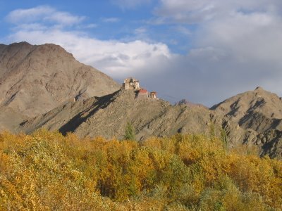
the gonpa in diskit

